
The Places of Issues
The Places of Issues
This recipe focuses on using online devices to explore the location of issues. It follows a series of research projects which use the web to delineate and investigate geo-locative concerns (Rogers, Weltevrede, Niederer and Borra 2012; Marres and Rogers 2008), such as national webs, relations between global and local sources as well as locative dynamics online (Weltevrede forthcoming; Weltevrede and Helmond 2012). Studying the places of issues is concerned with the spatial distribution of issues or the specificity of issues as defined through devices delineating locative web spheres. Analytically, it deploys location based data for the study of issues. There are several pathways to explore the places of issues. A key approach is to map the distribution of issues based on the location of key actors, for instance creating geo-locative maps of issue crawler networks. A different approach is to focus on issues as defined and demarcated by specific regional, national or language based sources, such as comparing issue networks derived from different national Googles. The following recipe outlines key steps to determine the places of issues and compare different locative distributions of issue spaces. For this purpose, the recipe repurposes, that is build on top, different national Googles to demarcate national issue spaces and draws on devices that determine the geo-location of sources or actors.
1 |
Where? Determine a Google query for the issue. If focusing on a particular county, translate the issues to all official national languages of the associated country. A list of official languages per country can be found here. Use the Google scraper to query the related national Google (a list of available national Google versions can be found here) and retrieve a selection of top results. | 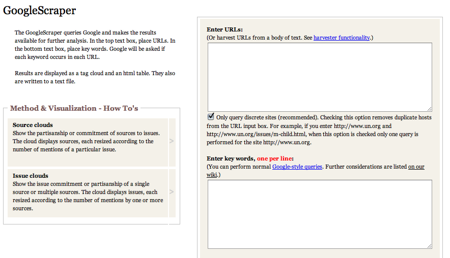 |
2 |
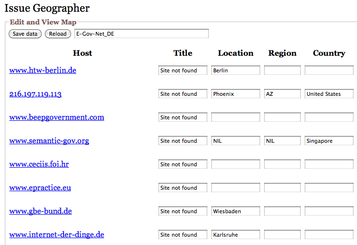
Determine source location Use the Issue Geographertool to determine the geo-location of the selected sources. The tool allows you to input a number of URLs and determined the registered location for the host of each URL. The Issue Geographer may not always detect the locations of all inputed URLs. To complement the data and clean it, several steps are possible: – Manually double check location coordinates on www.who.is – Check the contact details provided on the website. – Use Wikipedia or Google to determine the location of the organisation. Complement the Issue Geographer results with the manually retrieved data. |
 |
3 |
Visualise results Use the in-build visualisation of the Issue Geographer to plot the results on a world map. You can now determine where the top sources are located in relation to the associated country and issue. | 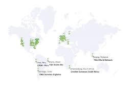 |
4 |
Comparative study In order to compare the places of issues across different countries, repeat the process for further countries or language regions. Select the respective national Google version for each country in the Google Scraper and translate the query into the official languages. The resulting maps will allow tracing networks of common issue sources across countries, determine shared or specific sources and enable to make claims about the global or local distribution of issue sources. |